
Quick answer
The bosphorus river cruise map displays the full strait route from Eminönü İskelesi north to Anadolu Kavağı, marking 14 stops across both European and Asian shores. The map distinguishes between short Bosphorus tours that turn back at the second bridge and the full round-trip service departing at 10:35, which reaches the Black Sea entrance before returning. Each stop is numbered sequentially, and the map indicates which piers serve morning versus afternoon departures.
Every public ferry in Istanbul carries a laminated route diagram near the gangway, but the bosphorus river cruise map differs from standard commuter charts in one critical way: it segments the strait into tour zones rather than municipal districts. The full-day cruise operated by Şehir Hatları traces the entire 32-kilometer channel, calling at fortresses, fishing villages, and waterfront mansions that define the strait's character. The map itself uses a vertical orientation, mirroring the north-south flow of the Bosphorus, with European shore stops on the left and Asian landings on the right. Most confusion arises when travelers conflate the short-loop tourist boats with the official municipality ferry. The short cruises, which depart hourly from various piers, turn back at Bebek or Ortaköy and rarely exceed 90 minutes. Their maps show a compressed route. The full Bosphorus cruise map, by contrast, extends to Anadolu Kavağı—the northernmost village before the strait opens into the Black Sea—and includes a mandatory two-hour lunch stop. That stop appears on the map as a bold anchor icon, signaling the midpoint turnaround. Reading the map requires recognizing three types of markers: red circles indicate mandatory stops where the ferry docks for passenger exchange, hollow circles mark scenic waypoints the boat passes without stopping, and the dashed line traces the international shipping lane that bisects the strait. The Fatih Sultan Mehmet Bridge and the Bosphorus Bridge appear as horizontal bars, and their positions help orient first-time riders. Palaces, fortresses, and historic yalıs are labeled in Turkish along the shoreline, with small illustrations denoting their architectural style. The map distributed at Eminönü İskelesi matches the route published on the official Şehir Hatları website, but printouts sold by kiosk vendors near Galata Bridge often omit the lunch-stop notation and compress the northern section. Riders planning to disembark at a specific village should confirm their intended pier appears on the route before boarding, as not every illustrated landmark corresponds to a docking point. The 10:35 departure follows the complete map, while earlier and later services may abbreviate the route depending on the season.
“The map distinguishes short-loop tours from the full strait crossing by marking the lunch stop at Anadolu Kavağı with a bold anchor icon.”
Understanding the Bosphorus River Cruise Map and Route
The full Bosphorus cruise follows a round-trip route from Eminönü to the Black Sea entrance and back, covering approximately 32 kilometers each way. The entire journey takes roughly 6 hours, with a stopover at Anadolu Kavağı.
Departure from Eminönü
The ferry departs northward along the European shore, passing Dolmabahçe Palace and Ortaköy Mosque within the first 20 minutes. Stay on deck for clear views of waterfront landmarks.
First Bosphorus Bridge Passage
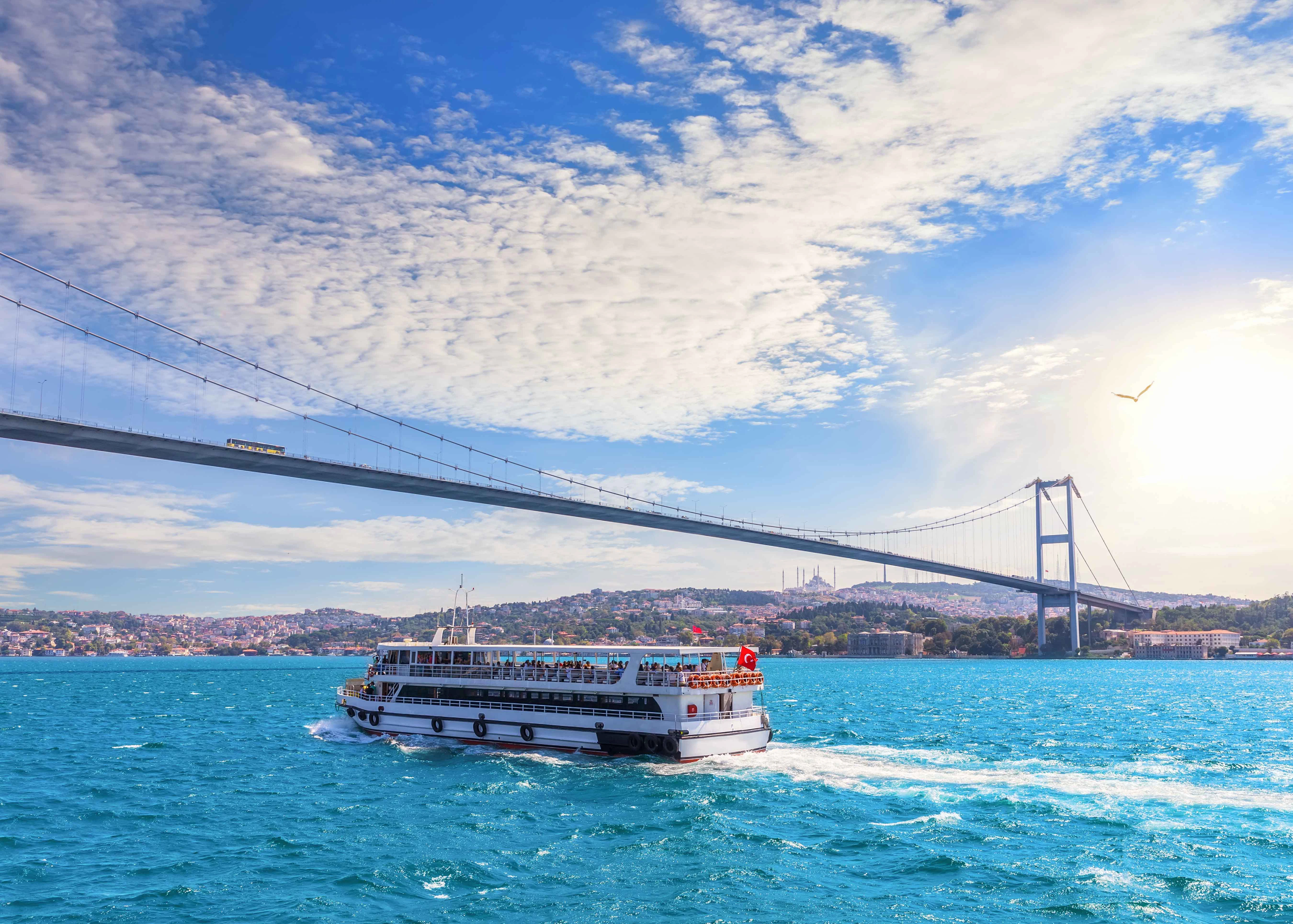
The route crosses under the 15 Temmuz Şehitler Bridge, marking the midpoint between Old Istanbul and the strait's narrower sections. Rumeli Fortress appears on the European side shortly after.
Narrowest Point Navigation
The ferry navigates the strait's tightest section between Rumeli and Anadolu fortresses, where Asia and Europe stand 660 meters apart. Both shorelines display historic yalı mansions.
Anadolu Kavağı Stopover
A 2.5-hour break allows time to explore the fishing village, lunch at waterfront restaurants, or hike to Yoros Castle ruins. Return to the same ferry for the southbound leg.
Return Journey Begins
The ferry retraces the route southward, now offering views of landmarks from the opposite perspective. The Asian shore gets better light in the afternoon.
Arrival Back at Eminönü
The cruise concludes at the departure point after passing under both Bosphorus bridges again. Total time afloat is approximately 3.5 hours excluding the village stop.
Operational Hours for Bosphorus River Cruise Map Routes
The Bosphorus river cruise operates daily throughout the week, providing consistent access for those planning their transit along these routes.
| Monday | 07:00–23:59 | |
|---|---|---|
| Tuesday | 07:00–23:59 | |
| Wednesday | 07:00–23:59 | |
| Thursday | 07:00–23:59 | |
| Friday | 07:00–23:59 | |
| Saturday | 07:00–23:59 | |
| Sunday | 07:00–23:59 |
How to Reach Your Bosphorus River Cruise Map Departure Point
The departure point for your cruise is located at Eminönü İskelesi, situated in the Hobyar Mahallesi district of Fatih, İstanbul. Public transit options provide the most direct access to this waterfront location.
T1 line to Eminönü station
M2 line to Haliç station
Direct to Resadiye Caddesi
Key Landmarks on the Bosphorus River Cruise Map
The Bosphorus cruise route passes by a series of historical waterfront structures and engineering landmarks. These sights are visible from both sides of the vessel throughout the journey.
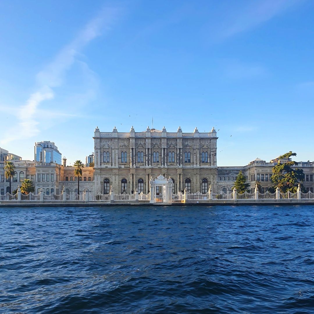
Dolmabahçe Palace
An expansive 19th-century palace built by the Ottoman sultans featuring European architectural influences.
View from the left side of the ship facing north.
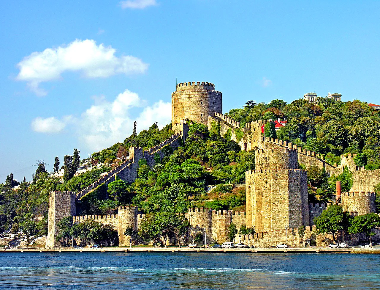
Rumeli Fortress
A massive stone fortification constructed by Mehmed the Conqueror to control the Bosphorus Strait.
Watch for the towers when approaching the second bridge.
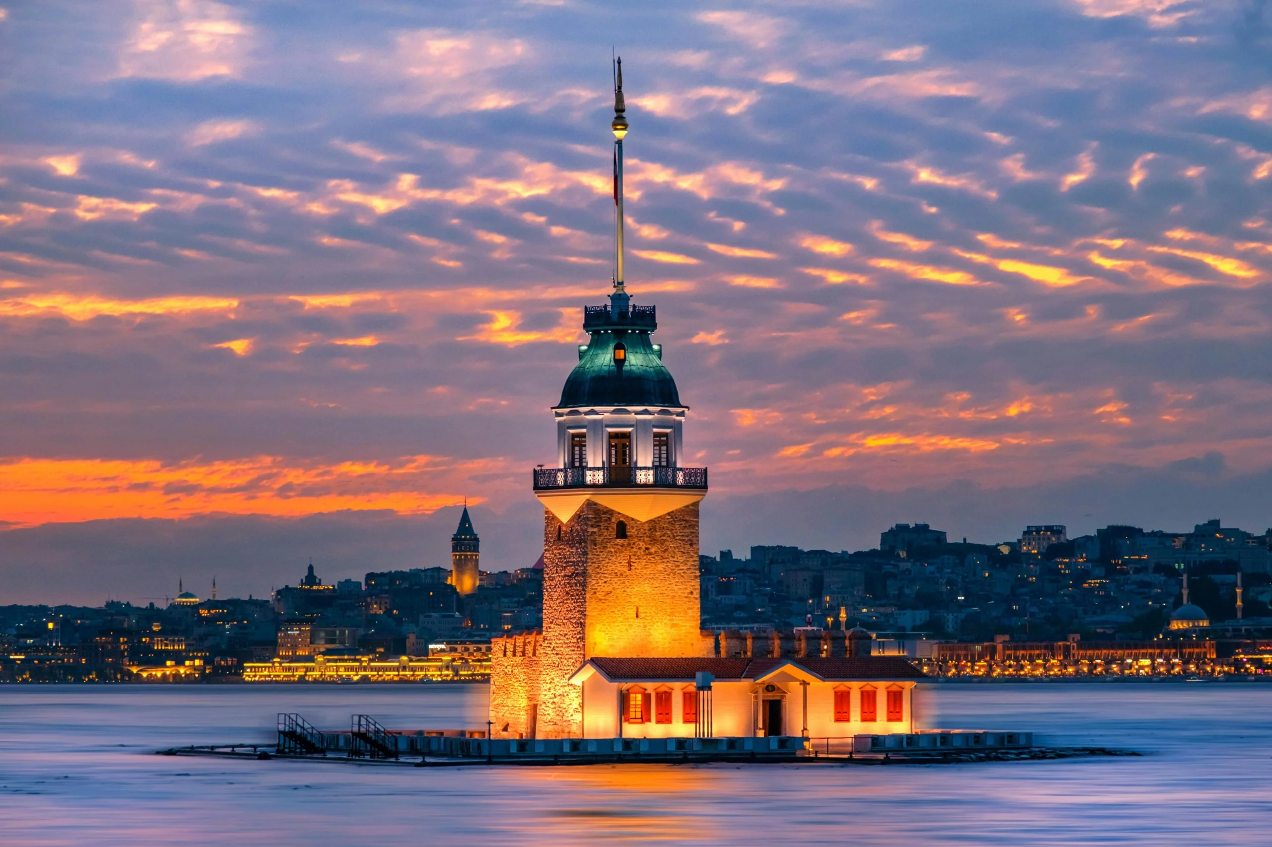
Maiden's Tower
A small, iconic tower located on a islet at the southern entrance of the Bosphorus.
Look toward the Üsküdar coast just after departure.
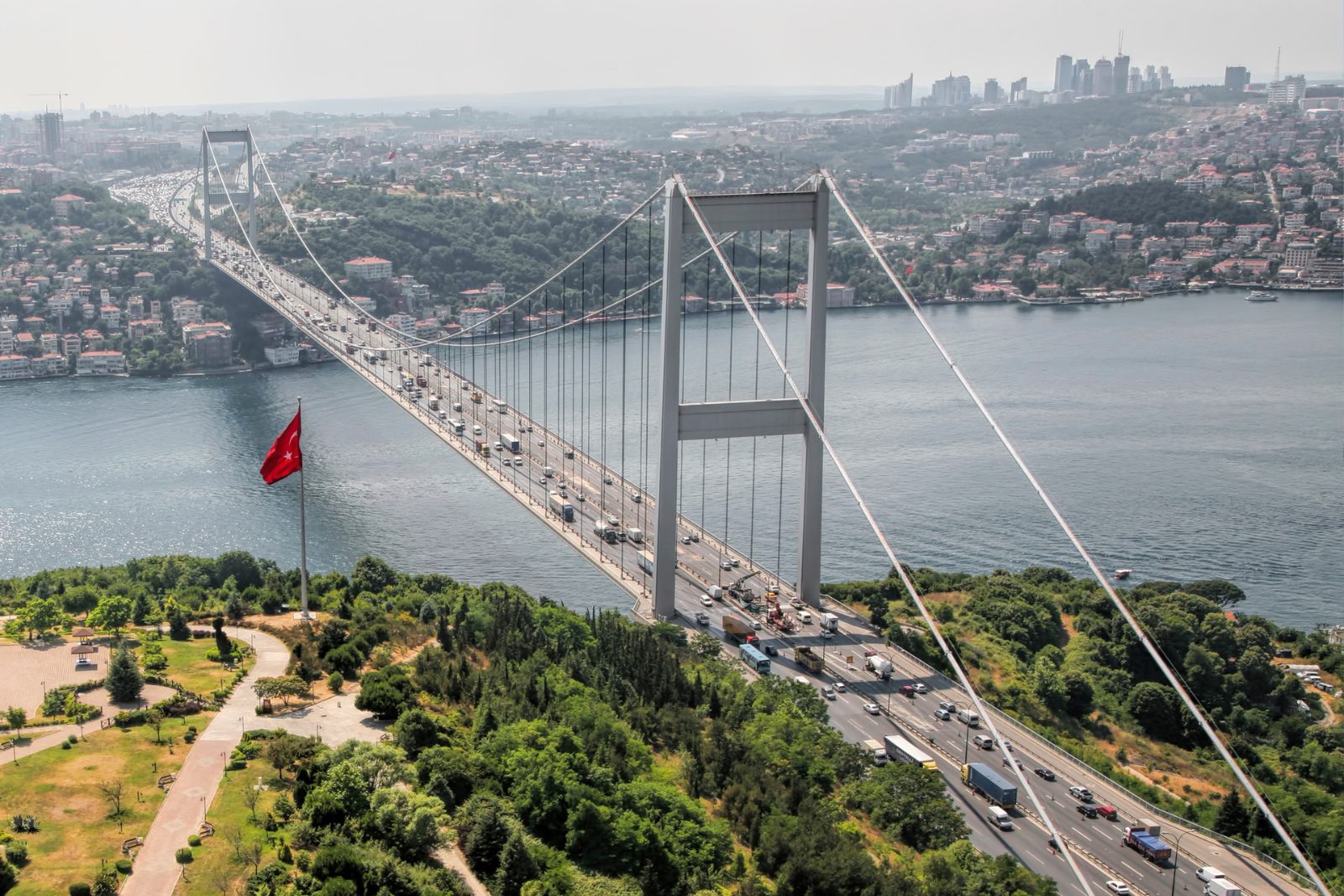
Bosphorus Bridge
The first suspension bridge to connect the continents of Europe and Asia.
Observe the vertical clearance when passing directly underneath.
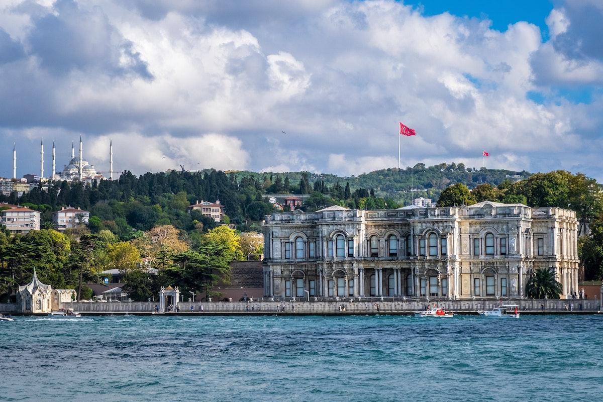
Beylerbeyi Palace
An imperial Ottoman summer residence located on the Asian shore beneath the Bosphorus Bridge.
Look for the ornate marble exterior on the Asian side.
Bosphorus River Cruise Map Pre-Departure Checklist
A short preparation list ensures a smooth departure from Eminönü pier.
-
Book tickets in advance — Walk-up availability varies, especially during peak season and weekends.
-
Arrive 30–45 minutes early — Allows time to purchase tickets at the pier and secure preferred seating.
-
Bring a route map or screenshot — Helps identify palaces, fortresses, and bridges as the ferry passes them.
-
Wear layered clothing — Upper deck temperatures drop on the water, even in warm months.
-
Charge your phone or camera — The six-hour round trip offers continuous photo opportunities along both coasts.
-
Pack water and snacks — Onboard refreshments are available but limited on the public ferry service.
Check availability
Frequently asked questions about bosphorus river cruise map
Everything you need to know about bosphorus river cruise map